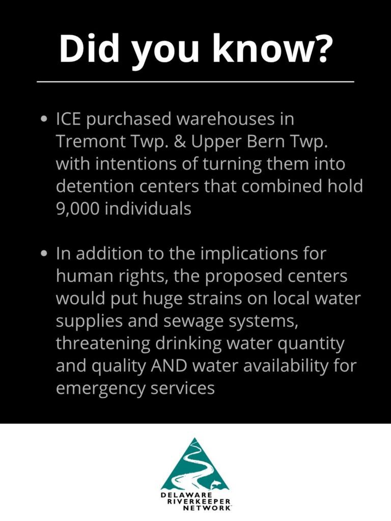
ICE Warehouses
Update: DHS Withdraws PA Environmental Hearing Board Appeal
In response to substantial public pushback, of which Delaware Riverkeeper Network played a significant part in due to our legal challenge to the proposed Berks County ICE detention center, the Department of Homeland Security has now formally withdrawn their appeal to the PA Environmental Hearing Board.
In addition to the implications for human rights, the proposed center would have put huge strains on local water supplies and sewage systems, threatening drinking water quantity and quality AND water availability for emergency services.
Background: On April 13, 2026, Delaware Riverkeeper Network filed a legal petition to help stop the Department of Homeland Security from advancing an effort to transform a Pennsylvania warehouse in Schuylkill County into an Immigration and Customs Enforcement (ICE) detention facility. The petition was in response to a DHS appeal to the PA Environmental Hearing Board, in which the federal agency sought amendments to PA Department of Environmental Protection-issued administrative orders that laid out the requirements of law, as well as additional prohibitions and limitations, regarding drinking water and sewage services for the site. On June 23, 2026, Delaware Riverkeeper Network’s petition to intervene was granted.
On July 22, 2026, DHS withdrew their appeal to the PA Environmental Hearing Board. There was no reason provided.
What Is Being Proposed?
The Department of Homeland Security (DHS), Immigration & Customs Enforcement (ICE) has purchased a warehouse located at 3501 Mountain Rd, in Upper Bern Township, Berks County PA. The facility is located in the Northkill Creek watershed, which is a tributary to the Schuylkill River and part of the Delaware River Watershed.
ICE intends to use the warehouse as a detention center, with plans to incarcerate up to 1,500 people onsite. In addition to those incarcerated at the center, employees will be needed for facility operation and management.
ICE asserts the detention center will be active and operating by November 30, 2026. And yet, it has not submitted applications for needed permits or approvals, including to supply needed drinking water and sewage services for the site.
On March 5, 2026, the Pennsylvania Department of Environmental Protection issued Administrative Orders to DHS and to the Township, laying out the requirements of law, as well as additional prohibitions and limitations, regarding drinking water and sewage services for the site.
On March 17, 2026, ICE acknowledged receipt of the PADEP order and requested a series of modifications, extensions, and revisions to what is being required of them, all in a clear effort to allow ICE to advance its plans for the site.
On April 8, 2026, ICE appealed to the PA Environmental Hearing Board seeking to have the administrative orders amended “to allow reasonable use of water and sewer systems, consistent with use permitted to prior property owner[.]”
Communities Are Standing Against ICE Warehouses
In addition to the implications for human rights, the proposed center would put huge strains on local water supplies and sewage systems, threatening drinking water quantity and quality AND water availability for emergency services. As a result, communities are standing up to say NO to ICE Warehouses—not just in Upper Bern, but across the country.
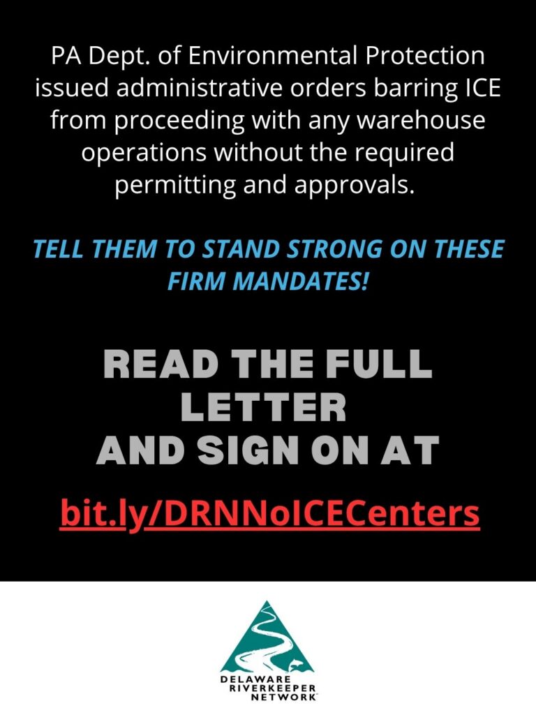
Sign on to Delaware Riverkeeper Network’s letter encouraging PADEP and Governor Shapiro to stand strong on the firm mandates issued to DHS and the Townships, which make clear that operations of the data centers are prohibited without the required permitting from PADEP.
READ THE FULL LETTER AND SIGN ON AT: bit.ly/DRNNoICECenters
Want to help spread the word further? Share these social media graphics so people in your community can learn about the warehouse threats and sign on in support of DEP’s firm mandates!

Background on Environmental Concerns
The following information was obtained from the Administrative Orders issued by PADEP.
Stress on the Water Supply
PADEP granted the previous owner—GACSD—approval to construct a noncommunity water system that could provide a maximum of 12,240 gallons per day (gpd) of water to the warehouse facility. Upon inspection in April of 2025, PADEP identified at least 6 ways in which the constructed system did not meet the requirements, and notified the facility that it may not be placed into service until it obtained a separate and specific approval from PADEP. GACSD has never sought nor received PADEP approval to operate the water system.
According to PADEP design standards, in order to support peak daily demand requirements, the center would require 180,000 gpd of water to support 1,500 incarcerated peoples. This figure far surpasses the 12,240 gpd the noncommunity water system—which currently does not meet PADEP requirements—was designed for.
Further, PADEP has not authorized a bulk water hauling system that could serve the site.
Strained Sewage Management
The Township Wastewater Treatment Plant has a maximum hydraulic capacity of 206,000 gpd of sewage. In 2025, the 3-month maximum flow for the plant was ~85,700 gpd.
Under previous ownership of the warehouse, it was anticipated the maximum sewage flow would be 8,000 gpd—an amount that PADEP acknowledged would not require revision to the Township’s sewage plan, as the flow would connect to an existing sewer line and would not overload on the Township’s wastewater treatment plant. DHS use of the warehouse as a detention center is expected to produce 112,500 to 225,000 gallons per day of wastewater, which would at least double the current flow to the wastewater treatment plant.
As recently as August 2025, unrelated to the warehouse, the Township submitted a corrective action to PADEP to address a suspected hydraulic sewage overload.
According to the PA Governor, operations of the detention center would “likely result in more than 14 times the legally permitted amount of wastewater, which would strain the local water treatment plant and pipe infrastructure posting a substantial risk of raw sewage polluting local waterways.”
Permitting & Approvals Needed
The increased drinking water flows required for the proposed detention center constitute a “substantial modification” to the water system, which cannot be modified without first obtaining an amended construction permit and/or an amended operation permit from PADEP.
- If ICE were to supply needed water through bulk water hauling, it would require a PADEP permit.
- In order for the facility to connect to the community sewage system or to even occupy the warehouse structure, a permit must be issued by PADEP.
- Given that the increased gpd of sewage from detention center operation would overload the Township’s wastewater treatment plant, the Township would have to amend its Sewage Plan and secure approval from PADEP in order to use a different mechanism for sewage treatment. This includes use of holding tanks, retaining tanks, privies or chemical toilets.
- In order to occupy the building, ICE must secure a permit and a certification from the Township confirming that sewage service at the property will consult with the Sewage Facilities Act and the Clean Streams Law.
PADEP also directed the Township to: not issue any permits for, or allow the occupancy of, the warehouse for any use other than a commercial warehouse; to not allow alternative methods of sewage management, and; to not provide water to or accept sewage from the warehouse; without the required PADEP approvals.